-

Qualtrics Platform -

Customer Journey Optimizer -

XM Discover -

Qualtrics Social Connect
Pergunta de mapa ArcGIS
Atenção: Esse tipo de pergunta só está disponível quando se usa a Nova experiência de realização de Pesquisa.
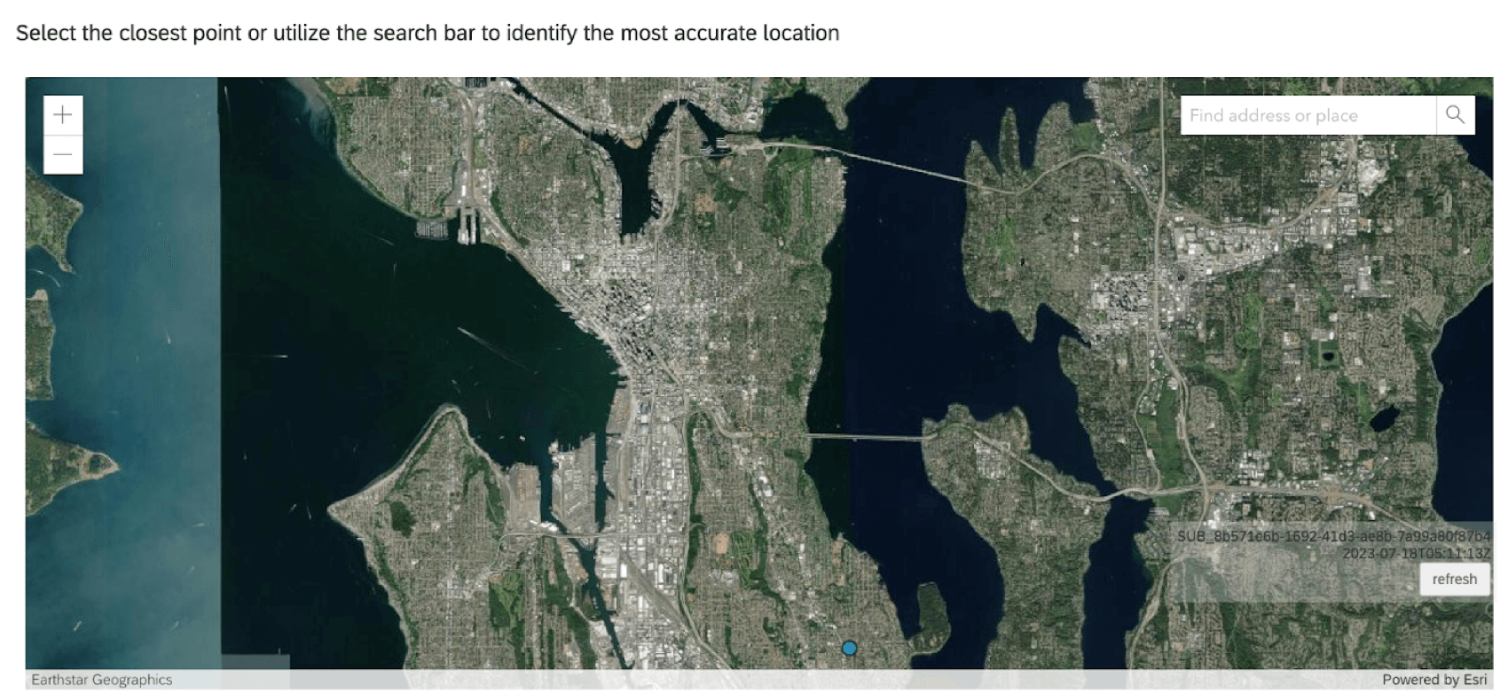
Sobre as perguntas do ArcGIS
O tipo de pergunta do ArcGIS permite que os respondentes pesquisa selecionem um local em um mapa. Esse ponto de localização pode ser compartilhado com o ArcGIS por meio da Tarefa Update ArcGIS.
Atenção: Cada pergunta do ArcGIS em seu pesquisa deve ser vinculada a uma Tarefa de atualização do ArcGIS separada .
Opções de mapa
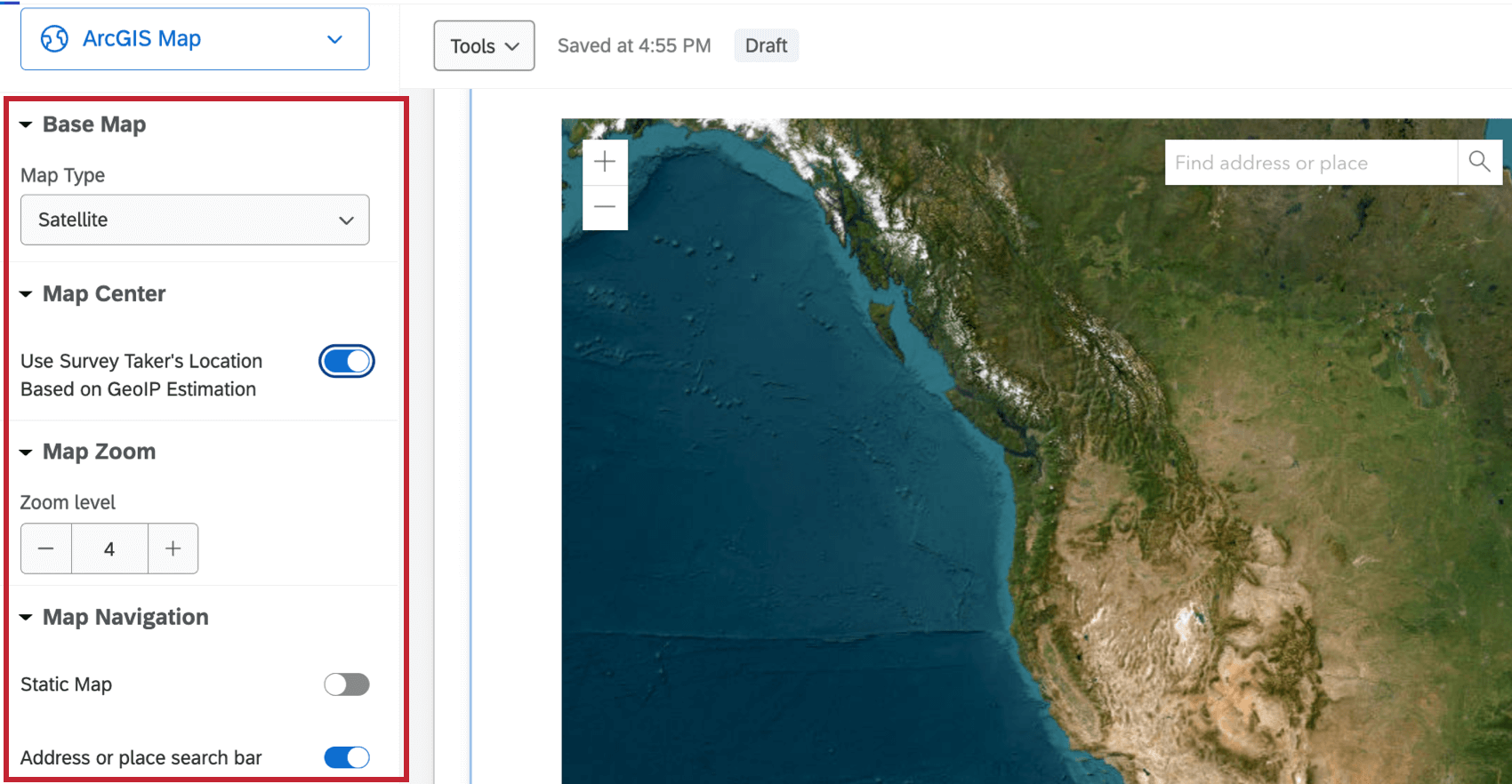
As perguntas do ArcGIS têm 4 opções ajustáveis.
- Mapa base: Selecione o tipo de mapa exibido para o entrevistado. As opções incluem Satélite, Oceanos, Terreno e muito mais.
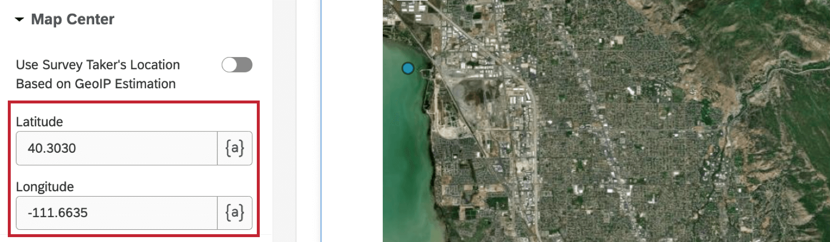
- Centralização do mapa: Quando ativada, essa opção centraliza o mapa com base na estimativa de GeoIP da localização do respondente.
Qdica: quando essa opção não está ativada, você pode definir a latitude e a longitude do local para o qual o mapa será padronizado.
- Zoom do mapa: Selecione um nível zoom do mapa. O valor deve estar entre 1 e 23.
- Navegação no mapa: Ativar ou desativar o mapa estático e a barra de pesquisa no mapa. Quando o mapa estático está desativado, os entrevistados não podem mover a localização do mapa. Quando a barra de pesquisa está desativada, os questionados não podem pesquisar um endereço ou local.
Análise de dados
Os dados de suas perguntas do ArcGIS Map estarão no seguinte formato:
{"geometryType": "point", "geometry":[{"x": <point-here>, "y":<point-here>}]}Para usar esses dados no ArcGIS, é necessário configurar uma Tarefa de atualização do ArcGIS na guia Fluxos de trabalho do seu pesquisa. Consulte a página de suporte Update ArcGIS Tarefa para obter mais informações.