-

Qualtrics Platform -

Customer Journey Optimizer -

XM Discover -

Qualtrics Social Connect
Descripción general básica de la extensión ArcGIS
Visión general
La extensión ArcGIS le permite recopilar y analizar datos geoespaciales de ArCGIS en Qualtrics, mejorando la profundidad y el alcance de su investigación. Una vez configurada la extensión, puede usar preguntas de ArcGIS Map en su encuesta para recopilar datos basados en la ubicación. Estos datos pueden luego enviarse a una capa en ArcGIS, lo que permite una mayor visualización y análisis.
Configuración de la extensión
Antes de comenzar a utilizar la extensión, deberá cumplir tres requisitos:
- Tenga la extensión ArcGIS habilitada para su licencia.
- Tenga el permiso de API de acceso habilitado para su licencia. Ver Permisos de usuario, grupo y División Para más información.
- Tener una cuenta organizacional de ArcGIS Enterprise o ArcGIS Online.
Consejo Q: ArcGIS Developer u otros tipos de cuenta no funcionarán con esta extensión.
Si no cumple con estos requisitos, comuníquese con su Administrador de Marca/organización o Qualtrics Ejecutivo de Cuenta.
Para configurar la extensión, necesitará crear una clave API y una capa en ArcGIS, agregar una pregunta de ArcGIS a su encuesta y configurar una tarea de ArcGIS. Estos procesos se detallan a continuación.
Cómo encontrar su clave API y capa de ArcGIS
Necesitará iniciar sesión en ArcGIS para capturar sus credenciales de API y la URL de la capa.
- En ArcGIS, cree una nueva clave API . Ver el Documentación de ArcGIS para obtener instrucciones.
- Crear una capa alojada. Estos se pueden alojar a través de ArcGIS o aplicarEdiciones. Para obtener instrucciones, consulte la Documentación de ArcGIS.
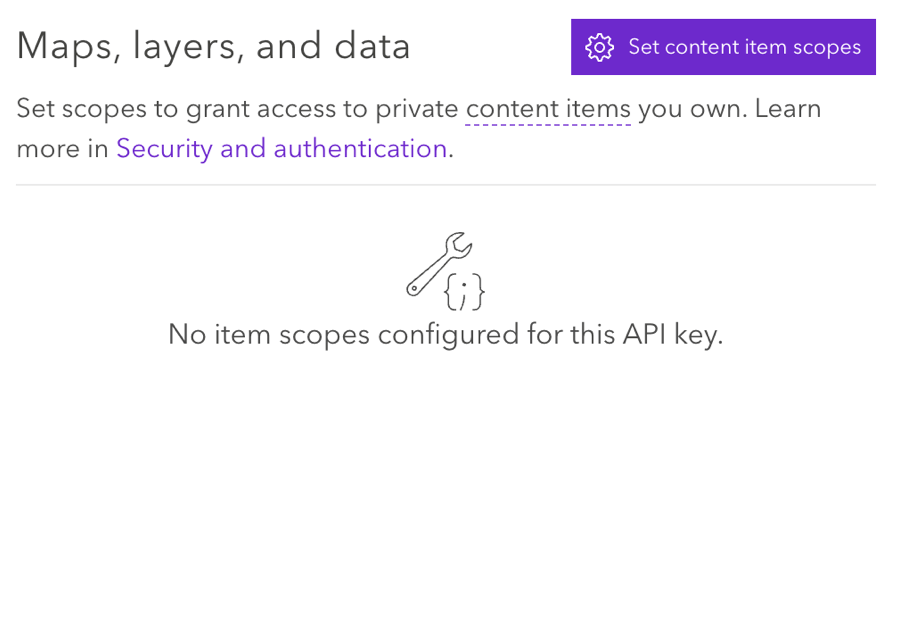
- En la configuración de la clave API , conecte la clave API y la capa alojada seleccionando Establecer los alcances de los elementos de contenido.
 Consejo Q: Asegúrese de que la configuración esté establecida en Permitir edición.
Uso de la pregunta sobre el mapa de ArcGIS
Necesitará agregar una pregunta de ArcGIS Map a su encuesta para comenzar a recopilar datos geoespaciales. Ver el Pregunta sobre el mapa de ArcGis Página de soporte para obtener más información.
Configuración de una Tarea de ArcGIS
Una vez que haya recopilado datos geoespaciales con una pregunta de ArcGIS Map, puede enviar estos datos a ArcGIS mediante la tarea Actualizar ArcGIS.
Ver el Tarea de actualización de ArcGIS Página de soporte para obtener instrucciones.